Survey & GIS
Our Expertise
The GIS and Survey Group at NEA Engineering Company provides comprehensive geospatial and surveying services to support hydropower, transmission line, renewable energy, and infrastructure projects. The group undertakes topographic, cadastral, and engineering surveys using advanced technologies including GNSS, Total Station, UAV photogrammetry, Ecosounder and UAV LiDAR. This team operates LiDAR Drones with H800 LiDAR sensor(only high capacity sensor in Nepal) which can take flying height upto 800 metres to deliver high quality LiDAR deliverables.
Key activities include feasibility and detailed surveys, transmission line route alignment and staking, check surveys, terrain modeling, and volumetric analysis. The team is also responsible for high-accuracy post-processing of geospatial data to generate DSM, DTM, contours, orthophotos, and high-density classified point clouds for engineering design and decision-making.
In addition, the group delivers GIS-based spatial analysis, mapping, and database development to support planning, environmental assessment, and project monitoring. Under experienced technical leadership of Group leader with reliable team of Survey Engineers, the team delivers accuracy, innovation, and industry standards datasets.
Project Experience
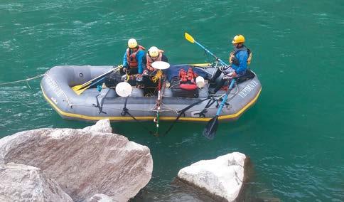
Bathymetric Survey Performed at Karnali River for Phukot Karnali Peaking RoR HEP
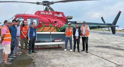
LiDAR Survey Based on Helicopter Platform Performed for 220kV Transmission Line from Matatirtha to Tinpiple of about 90km
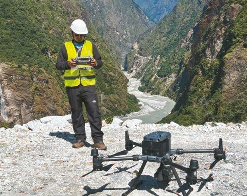
UAV LiDAR Survey Conducted for Upper Tamakoshi Hydroelectric Project
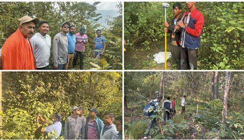
Check Survey of 132 kV Transmission Line of Bheri Babai Diversion Multipurpose Project